After a short break from the previous launch, we launched again on the morning of Saturday August 14th, 2021. The launch party was Martin W6MRR, Robert K6RGG, and myself KF6ZEO. We launched again from the northwest corner of the Berkeley Marina.
Martin W6MRR had made some changes to the tracker PCB layout to try and mitigate GPS RFI issues, but since none of the standard layout changes made were helping at all, we decided to use an older board design that flew previously. We also decided to bring two trackers. Each tracker was identical electronics and balloon inflation, just different callsigns.
![]()
Robert K6RGG brought his drone again and took some great video of both launches.
Launches
After powering on and checking the tracker for the first picoballoon, it was launched at 8:25am. WSPR callsign was W6MRR.
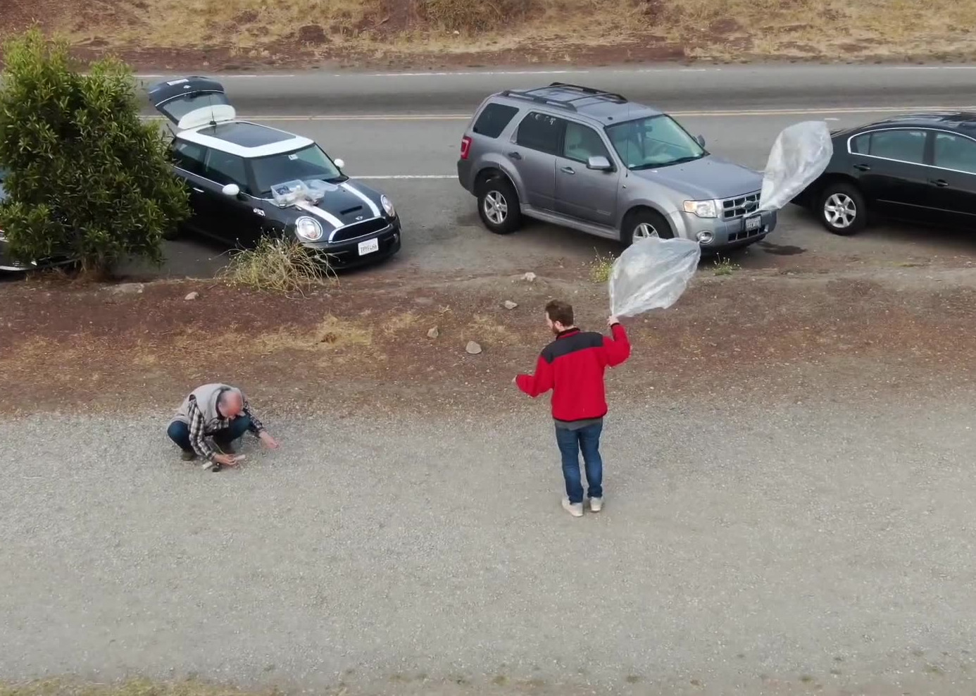
A few minutes after the first launch, we had tied the second tracker to the balloon and we were waiting for a lull in the breeze. The second balloon was released at 8:35am. WSPR callsign was KF6ZEO. Unfortunately, the lower dipole wire dragged in the bay for a bit before taking off, which may have added a bit of weight until the water evaporated off.
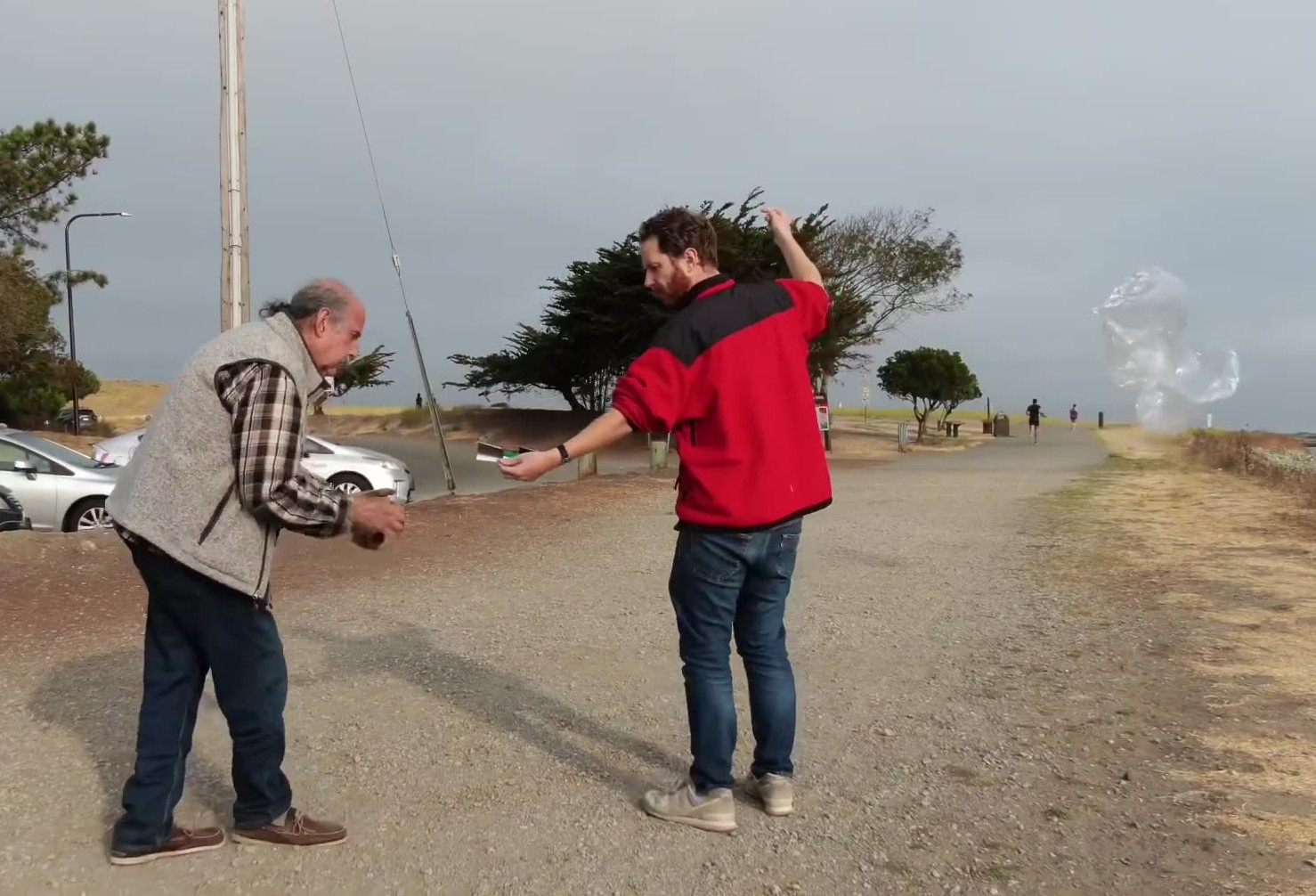
It seemed as if the second picoballoon rose much slower than the first, although the winds were a bit stronger so maybe it was just being blown further downrange.
HYSPLIT Forecast
After returning home, I ran a HYSPLIT forecast for this launch. I ran the forecast for 9000, 10000, and 11000 meters altitude, or 29.5k, 32.8k, and 36k feet, denoted by the red, blue, and green lines.
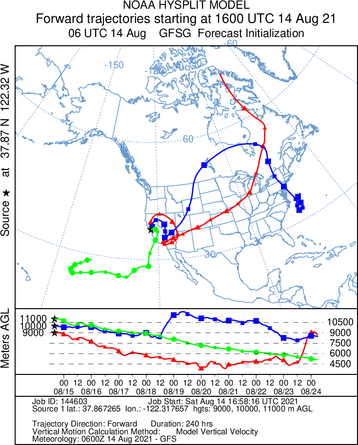
I chose these altitudes because even though our target altitude is 38k feet, we've never successfully attained that altitude on previous flights. As much as we have played around with different gas volumes and net lift, our previous flights have leveled off between 9,900 and 11,100 meters (~32.4k to 36.4k feet).
Looking at the forecast, it's super interesting to see the lower predictions amble around California for a few days then head east, but the 11,000 meter prediction heads west out towards Hawaii. So the final direction of these picoballoons will really depend on final float altitude.
Results
Unfortunately, neither picoballoon was heard from. This was a big disappointment, and breaks our streak of hearing from all of our previous balloons. And we wasted two trackers!
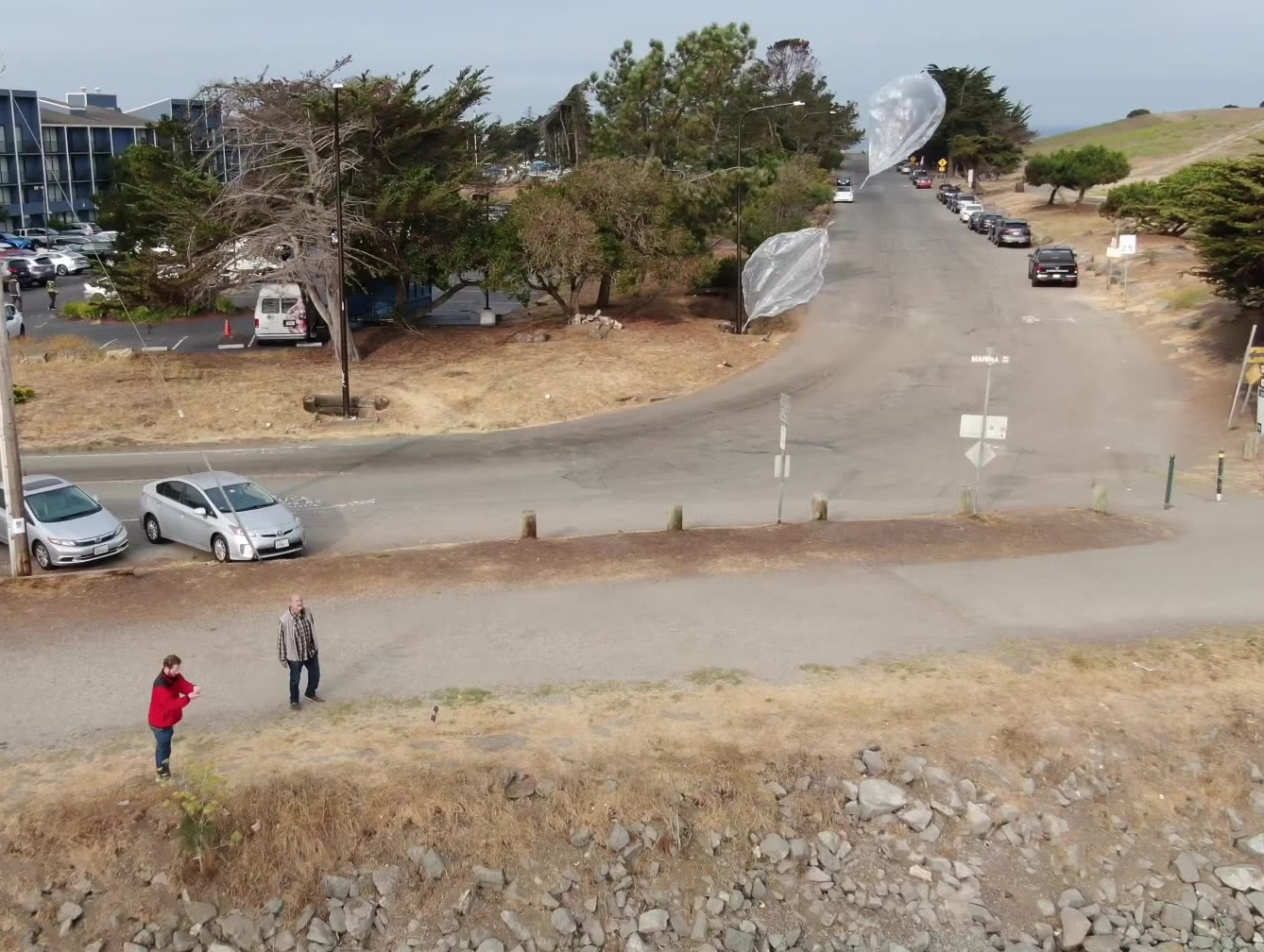
Our leading theory as to what happened involves the marine layer that morning. San Francisco was socked in with fog when I left home, and by the time I reached Oakland the fog was just beginning to break up along the tops of the hills. By the time we actually launched the picoballoons, most of the fog was gone, but there was still some scattered low clouds around.
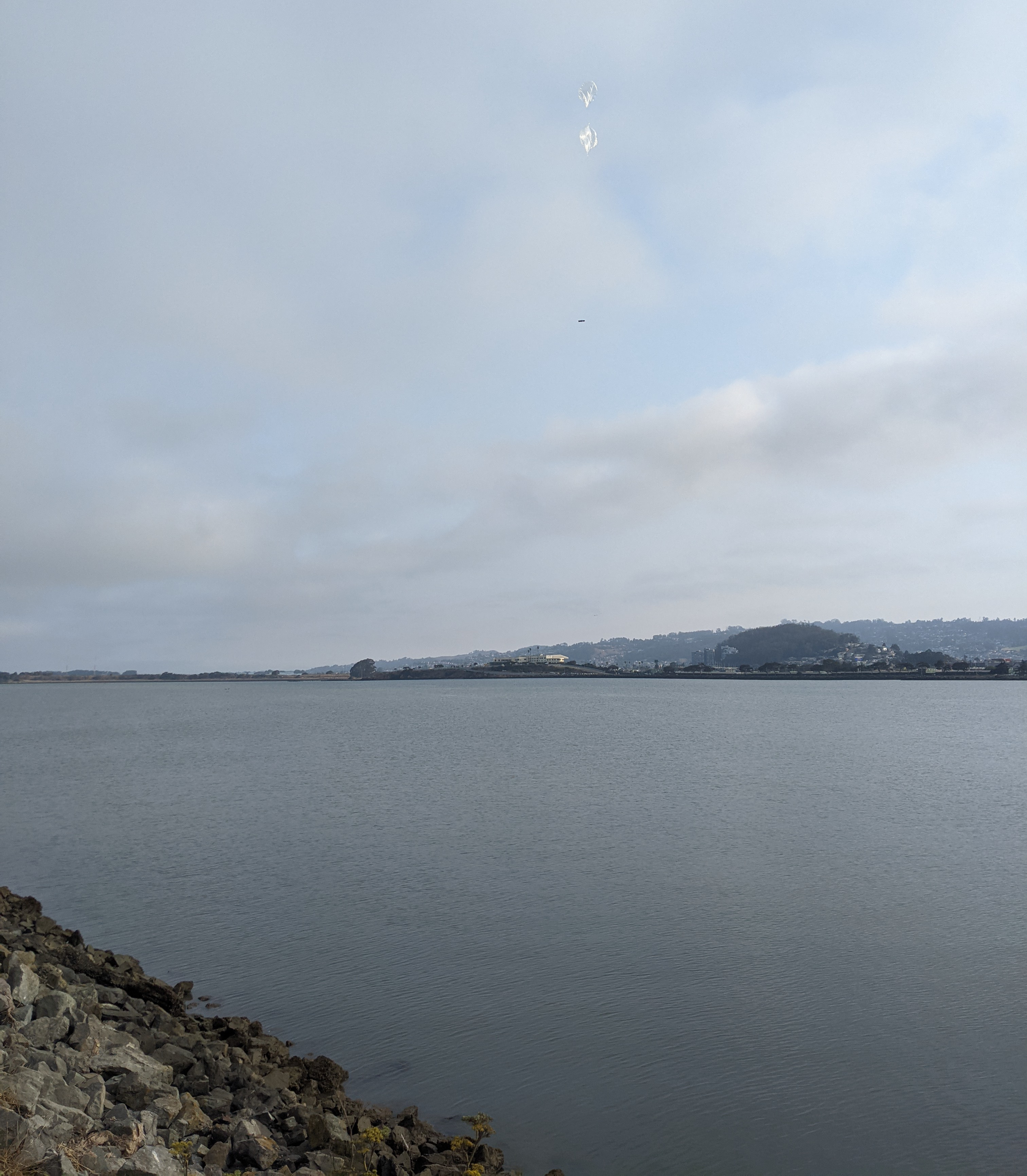
Looking at the launch of the second balloon, you can clearly see the marine layer breaking up behind the picoballoon. Both picoballoons would have needed to travel through these clouds to reach their cruising altitude.
Fog or clouds are a death sentence for picoballoons. These picoballoons only have 6 grams of free lift, so only a few grams (milliliters of water buildup) is enough to send the balloon plummeting towards the ground. The historical Meteorological Aerodrome Reports (METAR) from Oakland International Airport, approximately 11 miles south of our launch location, told the story of the marine layer that morning:
KOAK 141453Z 00000KT 10SM OVC008 17/14 A3008 RMK AO2 SLP186 T01670139 53007
KOAK 141553Z 17003KT 10SM BKN010 17/14 A3007 RMK AO2 SLP182 T01720144
KOAK 141653Z 27004KT 10SM SCT011 SCT150 18/14 A3007 RMK AO2 SLP183 T01780144
KOAK 141753Z 25006KT 10SM FEW006 FEW250 19/15 A3007 RMK AO2 SLP183 T01940150
Just before we met at the launch site at 7:53am local time (1453 Zulu/UTC) on August 14th (141453Z), there was 0 knots of wind on the ground (00000KT), 10 statue miles of visibility at ground level (10SM), but overcast conditions at 800 feet (OVC008). Overcast means a solid layer of fog/clouds.
By the time we actually got everything ready and the picoballoons launched at around 8:35am, it was pretty close to the 1553 Zulu METAR observation (141553Z). This observation showed that there was 3 knots of winds from 170 degrees (17003KT), visibility still at 10 statue miles (10SM), but the clouds were breaking up at 1000 feet (BKN010).
An hour later at 1653Z, the clouds were now scattered at 1100 and 1500 feet (SCT011 SCT150). But it wasn't until 1753 Zulu time (10:53am local) that the clouds were pretty much gone (FEW006 FEW250). With only 6 knots of wind at that time, maybe we should have waited until then to launch.
Lessons Learned
The biggest lesson we re-learned is that clouds are the enemy of picoballooning! Any moisture layer in the atmosphere will add a tiny bit of water weight to the picoballoon, which will end the flight. Clouds also reduce the amount of sunlight hitting the solar cells.
So in the future we will make sure that there is no fog or clouds on launch morning. This is particularly challenging in the Bay Area during August and September, as hot air in the central valley pulls in cool air from the Pacific Ocean, leading to the thick marine layer. It's not until October that the marine layer disappears and San Francisco has an Indian summer.
The bigger disappointment is that we knew not to launch when it was overcast. But I guess we got a little too excited when we saw the clouds breaking up, and figured it would be fine. It was not fine, and we learned this lesson again.