After the fourth launch, Martin W6MRR respun the tracker board to try and fix some GPS lock errors. Unfortunately, the new layout did not fix the self-interference, but we decided to launch the new tracker board anyways on Saturday May 22nd, 2021. The launch party was Rob NZ6J, Martin W6MRR, Robert K6RGG, and myself KF6ZEO.
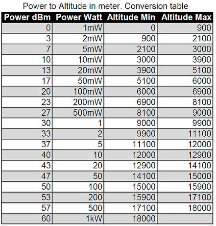
This time, Rob NZ6J brought a 20m receiver and speaker so we could actually verify the tracker was transmitting before letting it float away. While we didn't have any software to actually decode the packets, we were able to see that the transmitter on the radio S-meter. This is more of a nice-to-have, as the tracker board also has an LED that lights up when transmitting. The transmitter output power is a fixed 10 mW, and the altitude of the balloon is encoded in the "power" field of the WSPR packet according to this chart:
The WSPR callsign of this balloon was again W6MRR, and using the aprsWsprBridge.py script, was piped into the APRS network using the callsign W6MRR-16.
Launch
The big change we made this time (besides the new tracker PCB layout) was vertical stacking of the balloons. This made connecting the train sightly easier, although the bottom balloon looked much more deflated than the top one because of the pulling on both sides. Due to the winds, we also launched from the opposite end of the Berkeley Marina, near the southeast corner of Cesar Chavez park.
![]()
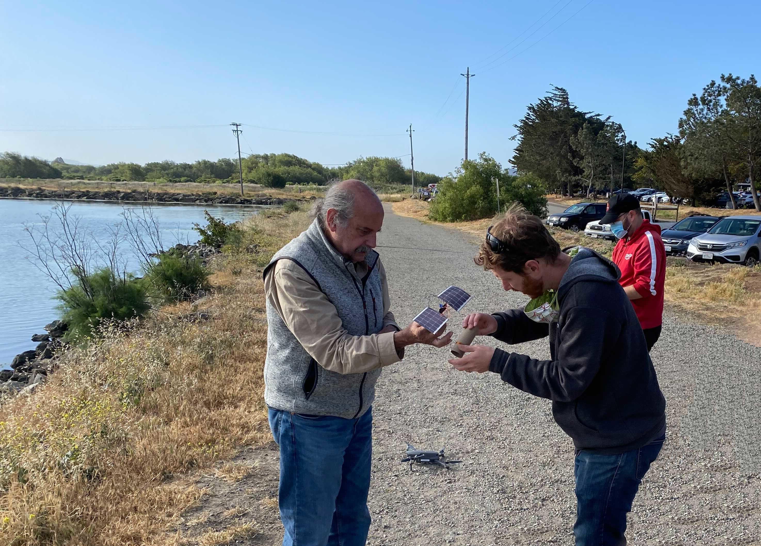
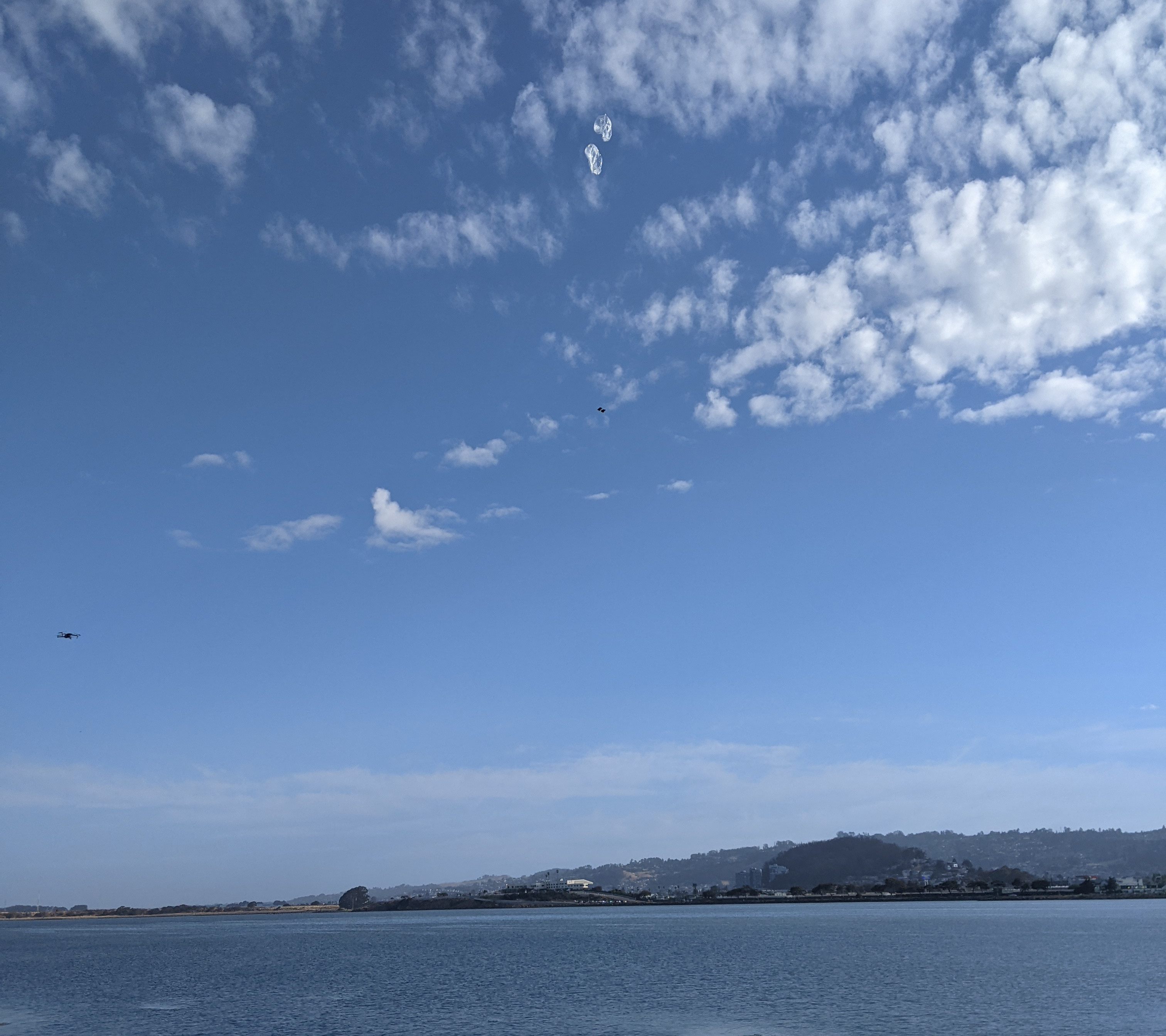
Robert K6RGG brought his drone again this time and got some decent footage.
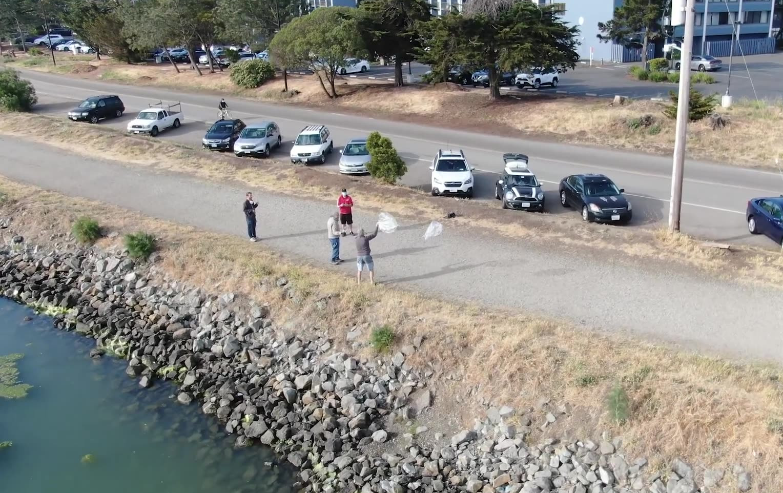
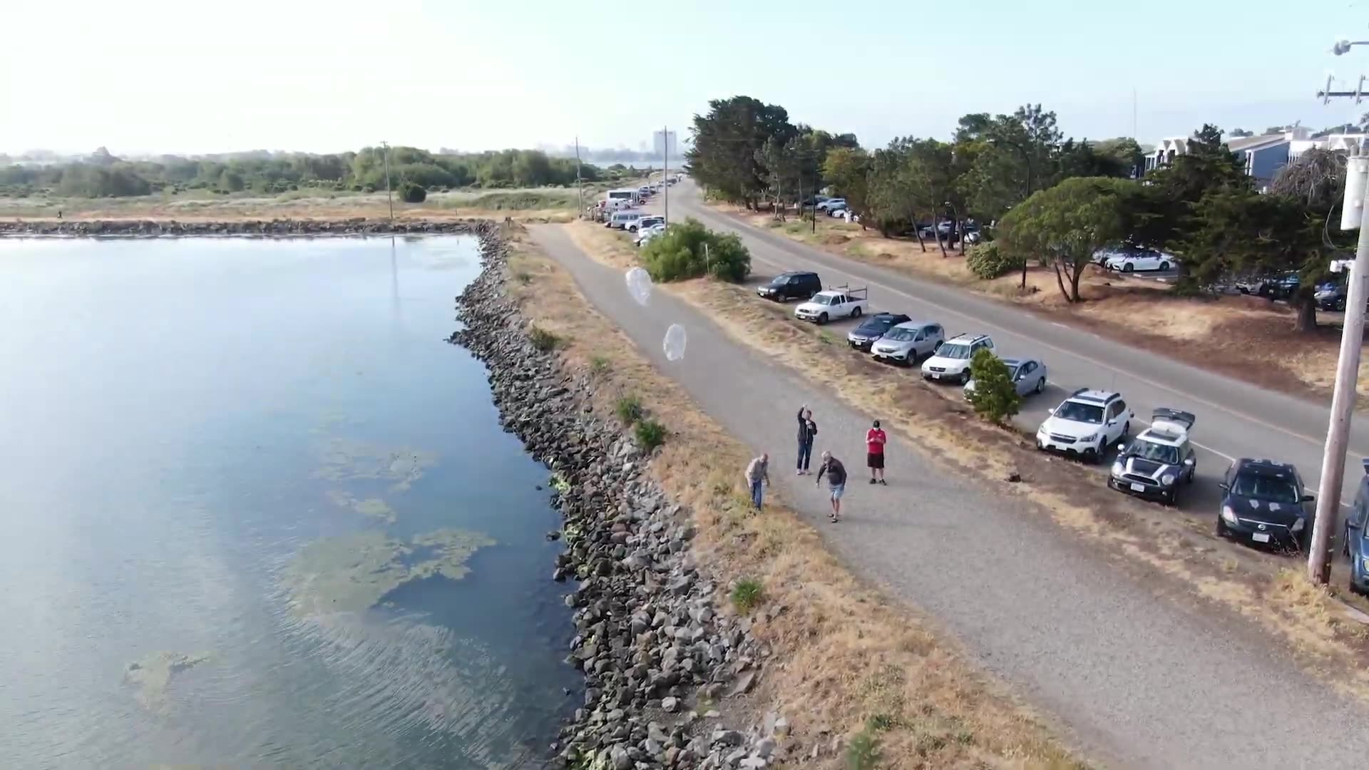
The winds this time were a bit gusty, so we had to wait for several minutes until it was calm enough to actually release the picoballoon. You can see Robert's drone on the left side.
Flight Data
The APRS callsign for this balloon was W6MRR-16. Since we had charged the supercaps just before launch, the tracker started transmitting only 30 minutes after launch.
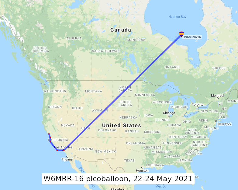
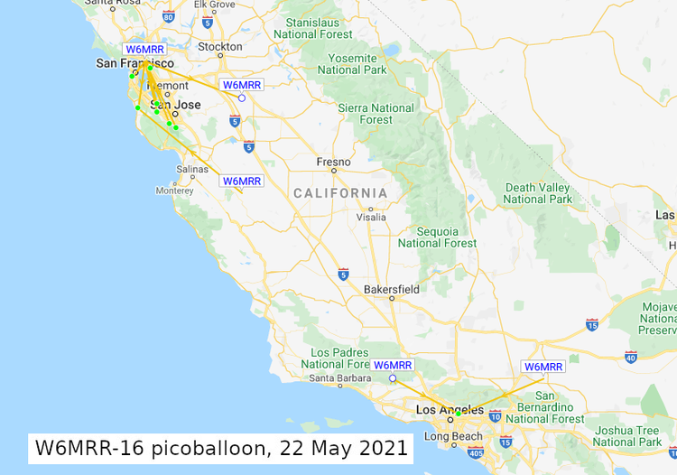
On launch day Saturday May 22nd, the balloon floated from the Bay Area south to Los Angeles. Here is a map from VK7JJ showing the balloon locations and receiving stations. A total of 39 packets were received by ground stations from 1532 to 2134 UTC. It took only 3.5 hours to reach 9,900 meters (~32.5 kft), which is an ascent rate of approximately 0.75 meters/second (~150 ft/min).
When flying over Los Angeles towards the end of the day, only two stations (WB6VIC and K6FOD) received the balloon flying around 33k feet. This is very interesting, as there are many WSPR receiving station in the Los Angeles area. I wonder why any other station didn't receive the balloon?
The tracker was completely silent on Sunday May 23rd, and we thought that might have been the end of the flight.
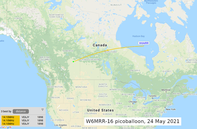
The tracker woke back up briefly on Monday May 24th, as it was flying over the Hudson Bay in Canada. A total of 3 packets were received by VE6JY, who lives just outside of Edmonton, Alberta. These were the last packets received from the balloon.
Transmitter Problems
Almost immediately after launch, we noticed that the balloon was not being heard in other states. Signal strength at my receiver in San Francisco was much weaker than the previous balloon. We quickly deduced that there was something wrong with either the Si5153A transmitter chip, or something happened with the antenna causing it not to radiate as well. The maximum reception distance for any packet was 1898 km on the third day, and only 3 packets were received by VE6JY on that day. These were the last transmissions received from the balloon, but who knows how many packets were actually transmitted that day?
Here is a graph of the maximum distance of receiving stations per WSPR packet. The average distance on launch day May 22nd was 75 km (~50 miles), corresponding to packets 1 thru 40 below. On May 24th when the balloon was over the Hudson Bay in Canada, VE6JY received three packets at almost 1900 km (~1200 miles) away, indicated by packets 41 thru 43 below. Stations that are in the same gridsquare as the balloon are marked as 0 km distance.
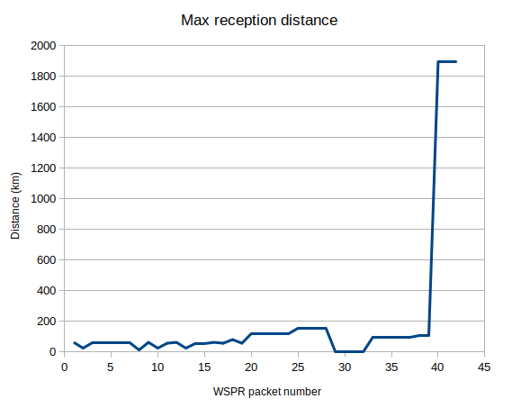
I wonder why the reception distance was so different on these two days. Maybe there was a software problem and the tracker needed to reboot itself? Or there were less high-level clouds over Canada so the solar cells collected just a few more joules, increasing output power? Or the ionosphere was more favorable to 20m propagation that day? One of the lessons learned from this flight is to make sure that the WSPR antenna is securely attached to the tracker board and not kinked or damaged in any way before liftoff.
All of the WSPR data is saved in a spreadsheet here.