I recently read an article about how a "cold blob" was interrupting the Atlantic Meridional Overturning Circulation (AMOC). This is pretty interesting, as the AMOC takes heat from Florida and brings it to Europe, keeping Europe warmer during the winter. The fear is if this current stops, winters in Europe will become a lot colder than they currently are. Towards the end of the article, they talk about using ocean float data for in situ measurements. That jogged my memory, I actually helped to deploy these ocean floats a long time ago!
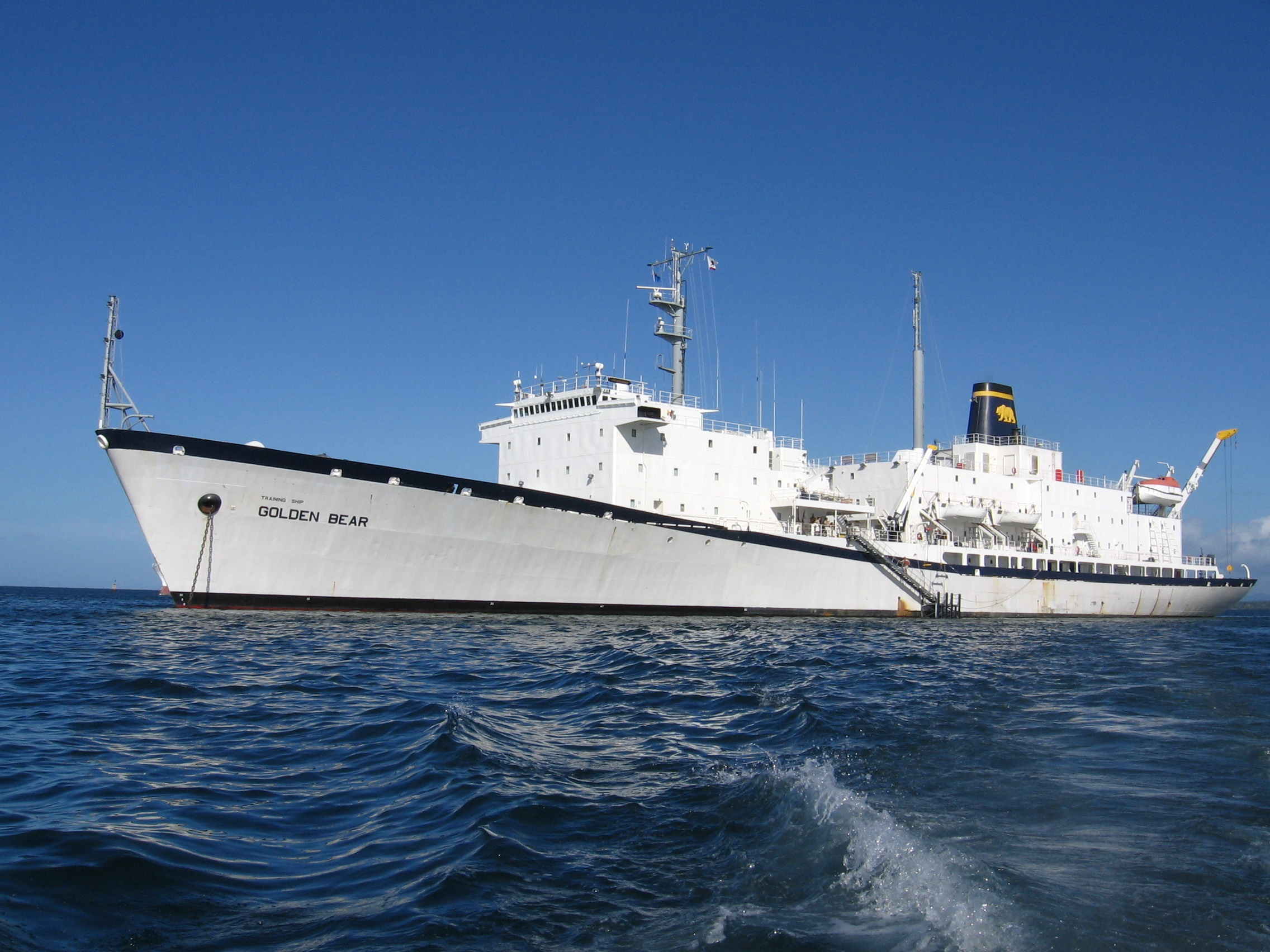
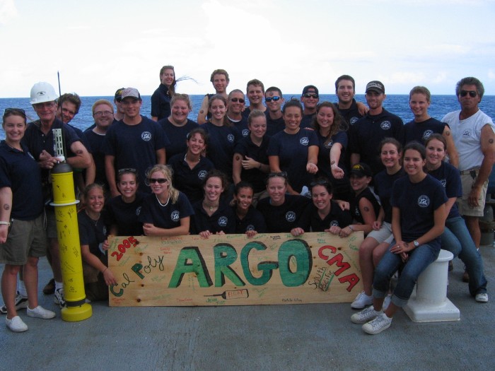
In spring 2005, during my junior year at Cal Poly San Luis Obispo, I participated in the Cal Poly At Sea program. This partnership between Cal Poly and Cal Maritime invites Cal Poly students to take classes about the Training Ship Golden Bear for two months. The trip was great, we sailed from San Francisco to Hawaii, Suva, Noumea, Sydney, and Brisbane, with a stop off at Palmyra Atoll on the way back to Hawaii. Professors from Cal Poly taught real classes on environmental chemistry, biology, astronomy, and political science.
Project Background and Float Info
Back in the 90s, some scientists were interested in currents and temperatures of the deep ocean. How is our world changing? How fast are the oceans actually heating up, and how will this affect life on earth?
Measuring the ocean is difficult. Ships, satellites, and buoys can easily measure the surface, but once you go below the surface things become harder, with communications and power being the biggest challenge. Using an oceanographic float is one option. This instrument can dive deep into the ocean, float with the currents, and make in situ measurements of the ocean currents, temperature, and salinity.
The Argo project is an international program that uses these floats to make these measurements. Our job was to get more of these floats in the ocean. Here is a diagram of a float cycle, courtesy of UCSD.
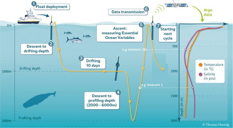
Ignoring the deployment phase, the float drifts along at 1000 meters deep for 10 days. Then it dives down to 2000 meters, and makes temperature and salinity measurements as it slowly floats back up to the surface. On the surface it transmits the data to satellites, then sinks back down to 1000 meters deep to drift for another 10 days. Then the cycle repeats. This "profile" of temperature and salinity measurements, from a depth of 2000 meters up to the surface, is what scientists are interested in. This data can tell us about how the oceans are changing.
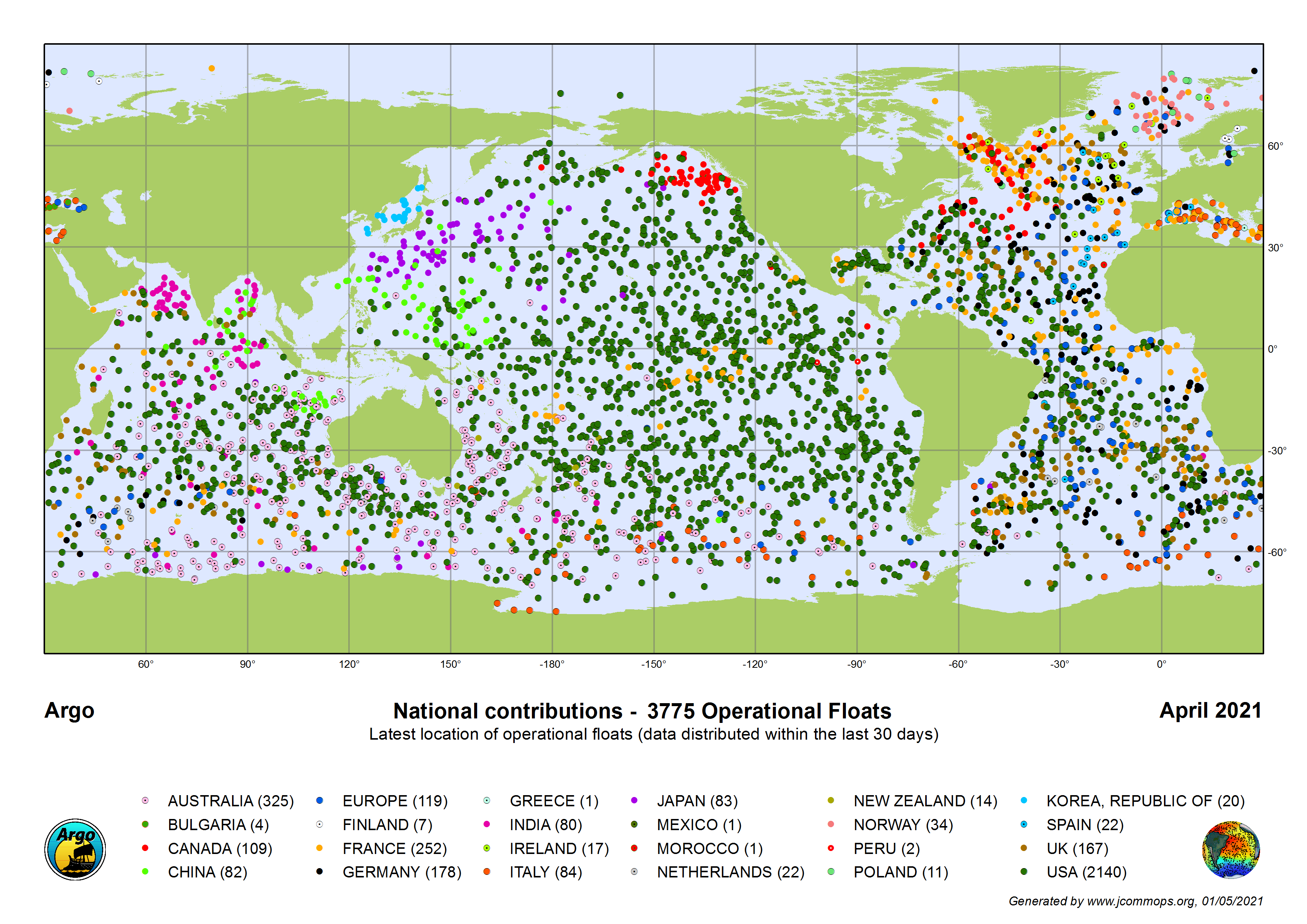
These Argo floats continue to collect temperature and salinity profiles until their batteries die, around 9 years for the floats we launched back in 2005. Through refinements in battery technology and electronics, lifetime has increased, and some floats launched in 2007 are still active in 2021. Here is a map from April 2021 showing all the active floats in the world, and their sponsoring country.
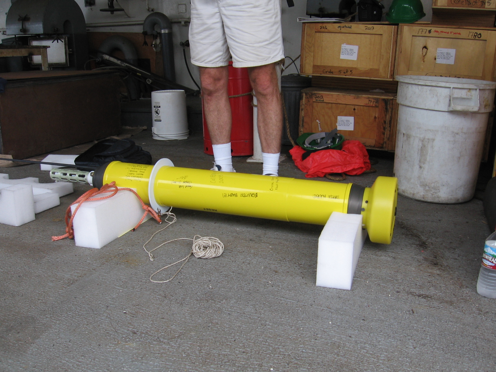
The floats we launched were manufactured by APEX. Each float is approximately 5 ft tall and weights 56 lbs (25,400 grams). The floats change their depth by changing their effective density. By expanding an external bladder with oil, they become a bit less dense than the surrounding water, and slowly float. To sink back down, the float sucks the oil back into itself, causing the effective density to increase. To make this density change work, each float is ballasted to approximately 2 grams.
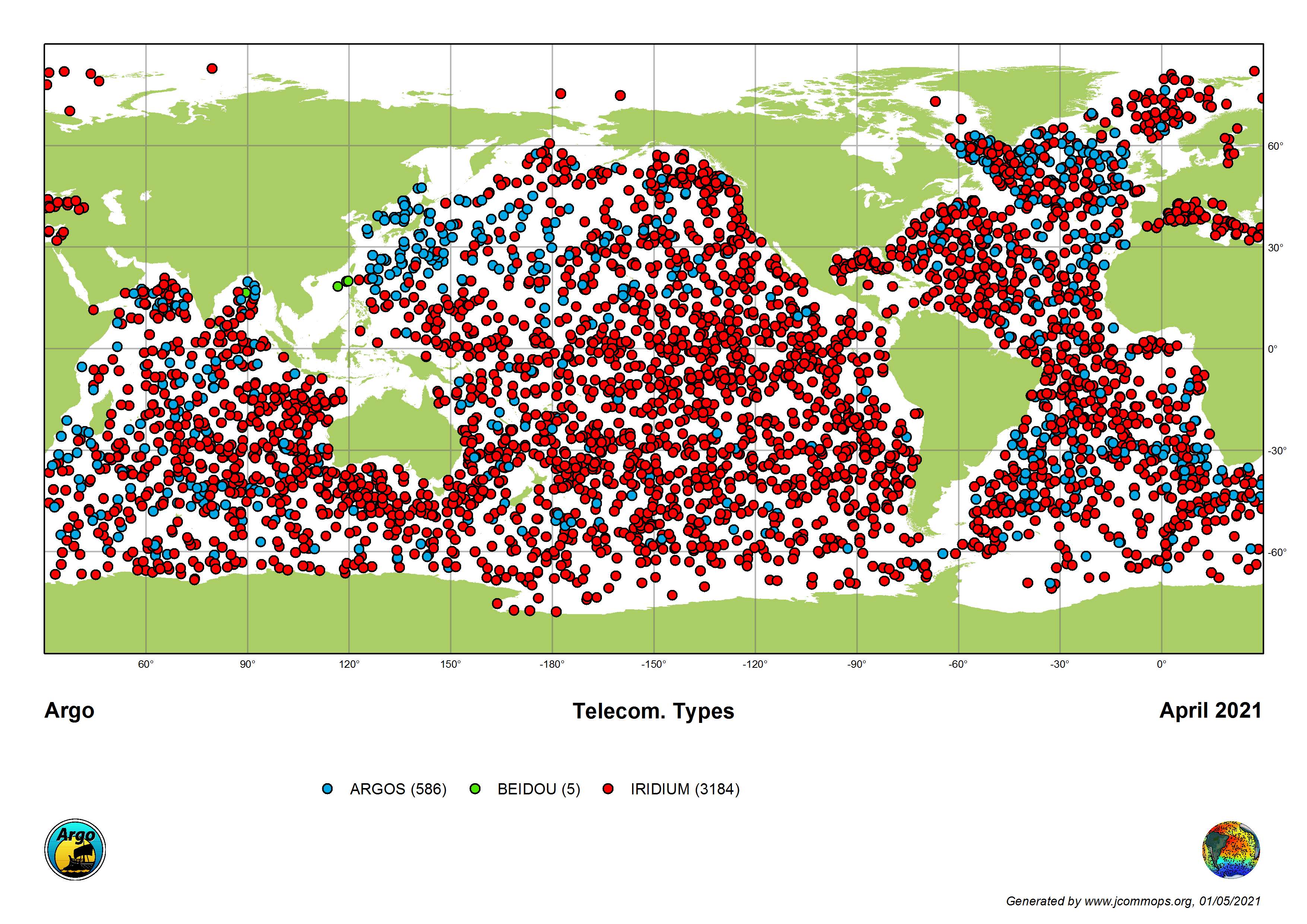
For communications, the Argo floats that we deployed in 2005 used the confusingly-named ARGOS satellite system. Floats transmit on 401.65 MHz, and the receivers are on several NOAA and ESA satellites in sun-synchronous orbit. Modern floats use the Iridium network to upload their data. Here is a map from April 2021 showing the communication systems for each float.
What's super interesting is that the older floats (that we launched in 2005) didn't have a GPS receiver, as GPS receivers back then were very bulky and took a lot of power. The ARGOS communications system uses the doppler effect to calculate the transmitter location, which is why the floats are on the surface for 12 hours. Several passes of the satellites are needed to calculate an accurate position. Modern floats have a GPS receiver for position.
Float Deployments
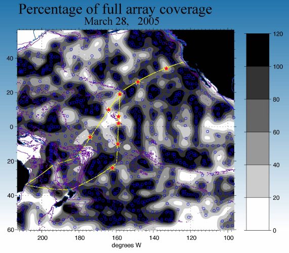
NOAA sent us a rough plan of where they wanted floats to be deployed. On this map, each active float is marked by a blue circle, and you can see the straight lines of floats deposited by boats on earlier voyages. The TS Golden Bear's preliminary voyage is marked in yellow, which was very different than our actual voyage, as we didn't stop at the Cook Islands or New Zealand. The darker areas already have good float coverage, and the white areas don't have any floats nearby. In total, we were only deploying 9 floats to fill in coverage gaps.
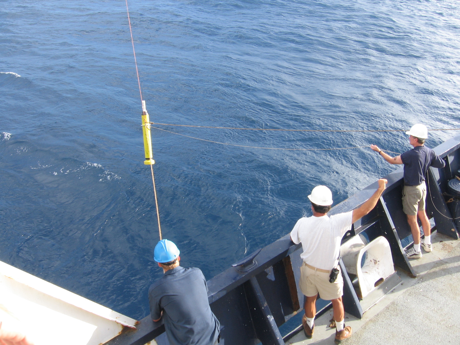
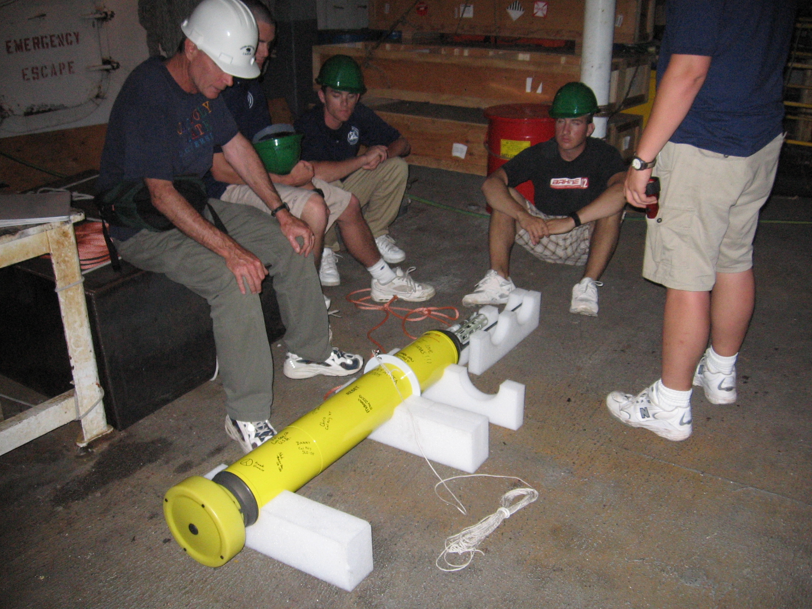
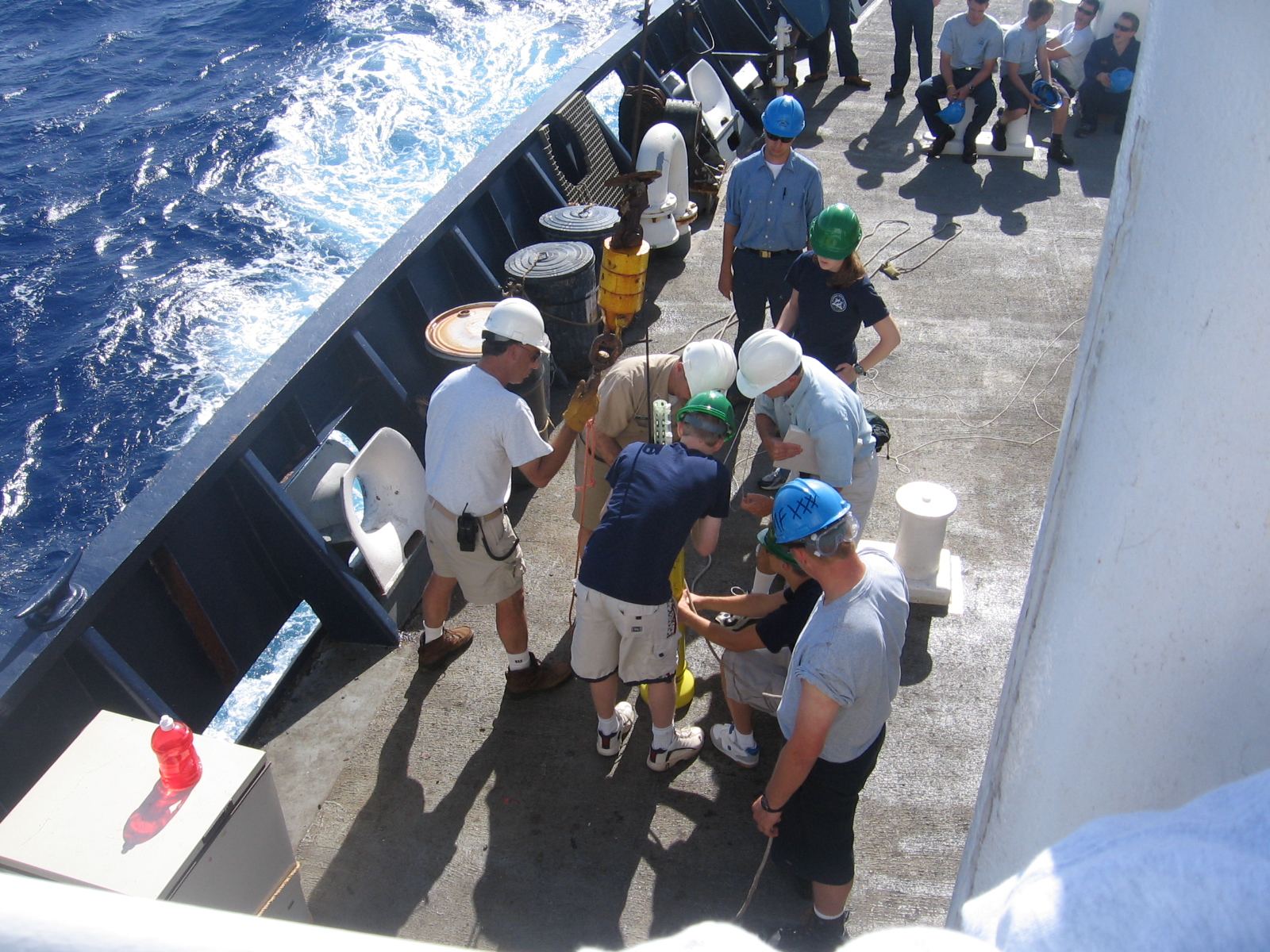
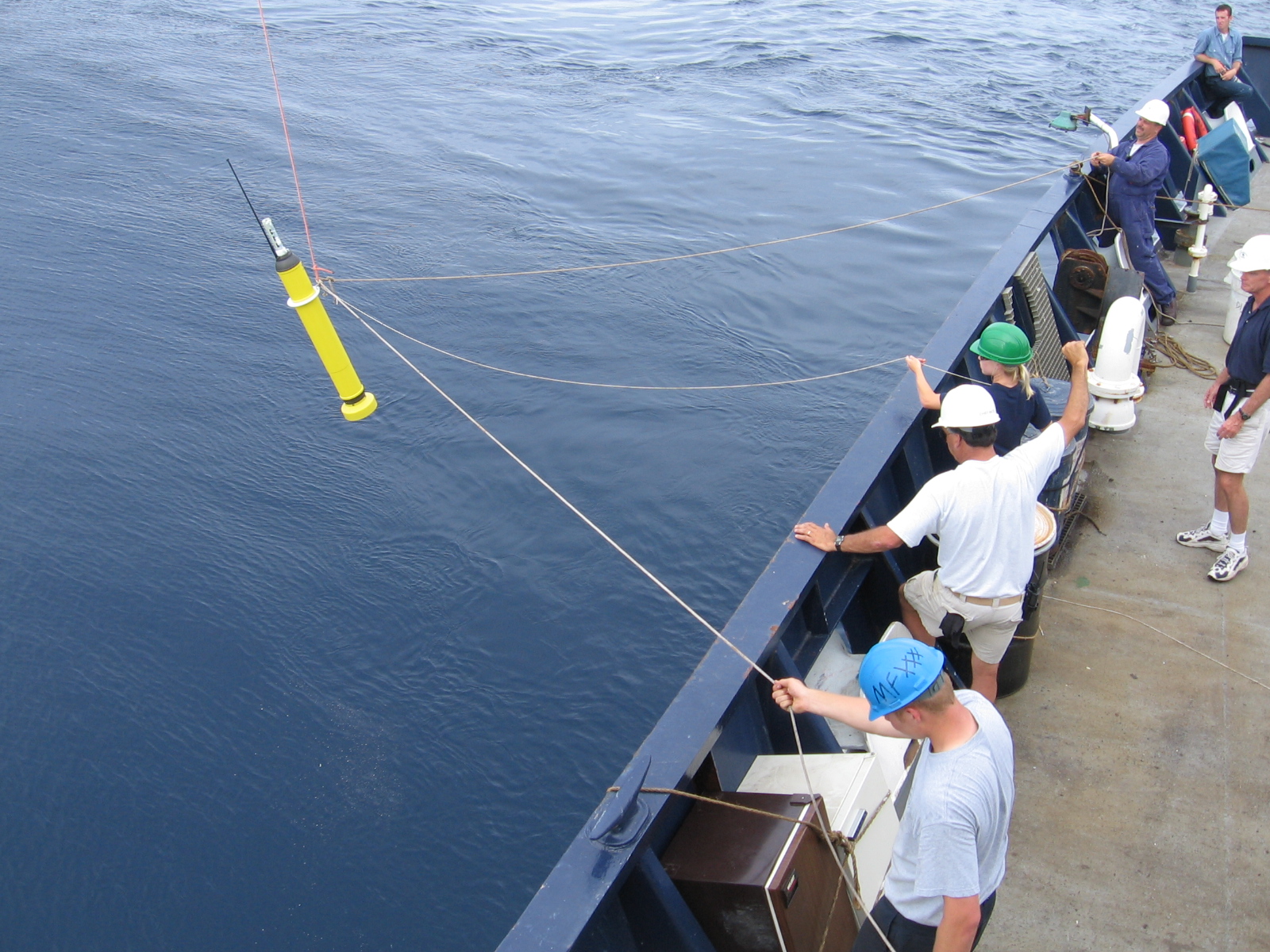
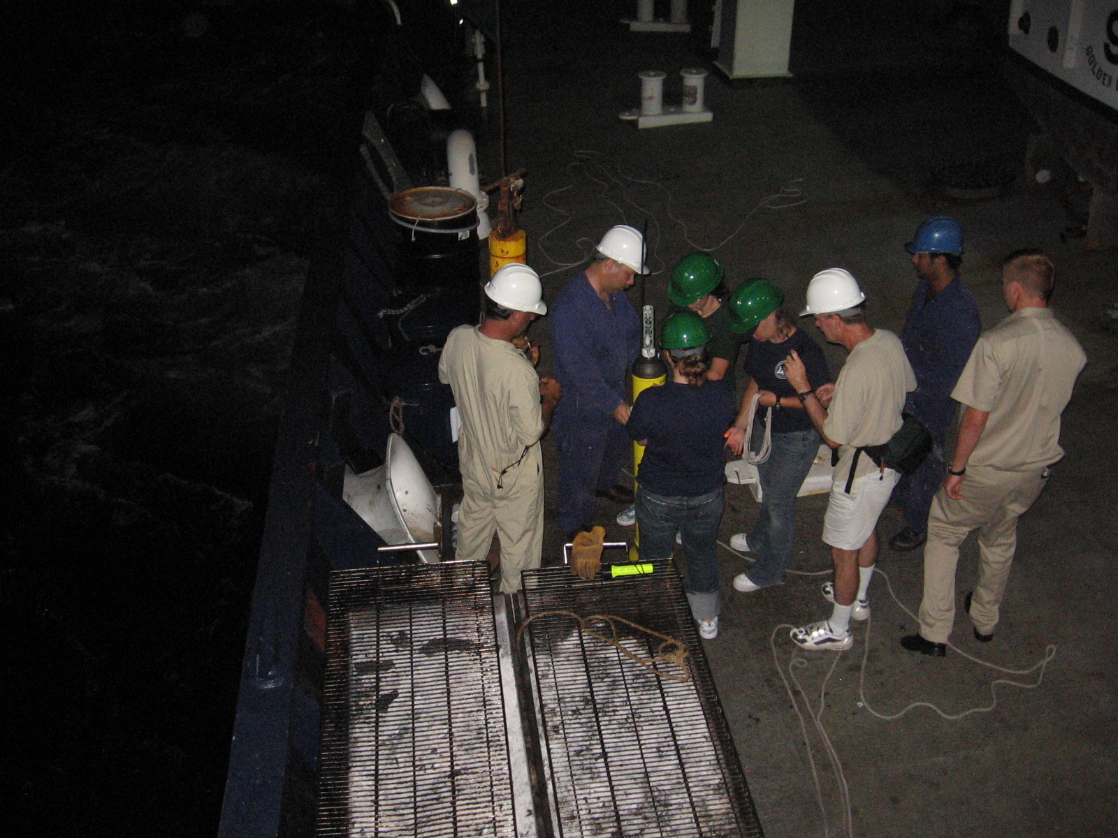
Powering the floats up and deploying them was very easy. About an hour before launch, swipe a magnet along the outside of the float to turn on the electronics. Listen for the pumps moving oil around, which is sometimes pretty difficult on a loud ship, and use a crude RF power meter to ensure that the ARGOS transmitter was working. When you get to the launch location, gently place it in the water and watch it float away.
Results
Our float success rate was decent, and we deployed a total of 9 floats on this voyage. Only one float failed to work at all after deployment, and several others had issues.
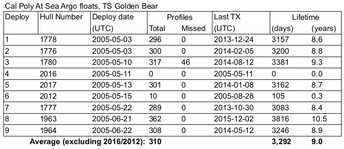
You can see the position, science, and telemetry data from each of these floats by clicking on their hull number on the NOAA PMEL webpage. Floats in other oceans can be seen on the JCOMM webpage. The average lifetime of the floats we deployed was about 3,300 days, which is about 9 years.
Here is a deeper dive (pun intended) into a few of the floats we deployed:
1780
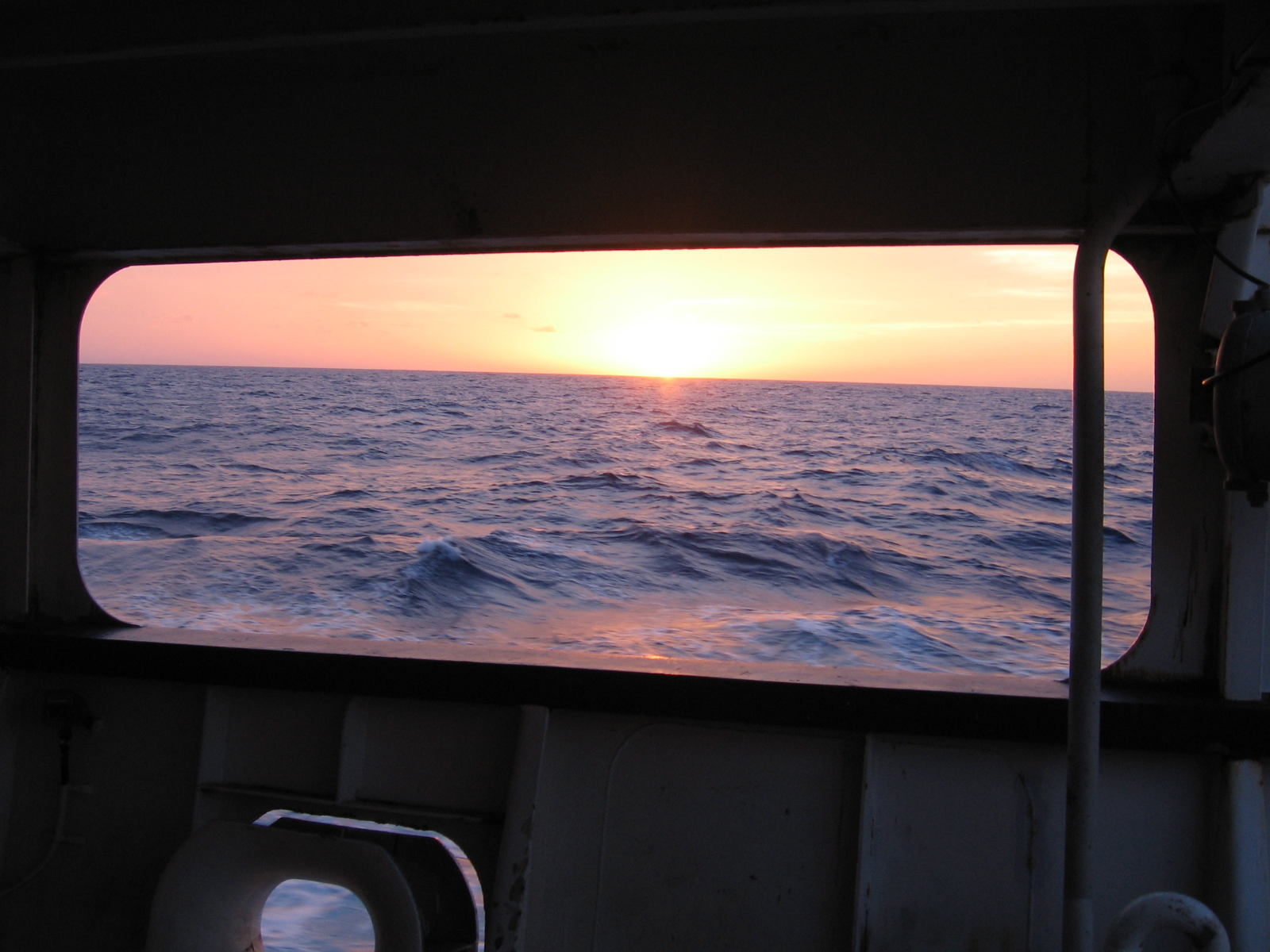
We deployed Float 1780 about two degrees south of Kauai on 10 May 2005. We had just left our first stop of Lahaina, Hawaii, and the float was uneventfully deployed just after a beautiful sunset.
For the first two years, this float drifted around the Hawaiian Islands. The water depth around the islands is pretty shallow, and if the float hits the bottom on the 2000 meter dive, it will just take measurements from the bottom to the surface. If the ocean depth is less than 1000 meters, the float will rest on the bottom for 10 days during its drifting phase, then take measurements on the way up.
If the float is resting on the bottom for 10 days, it's not going to drift far. In fact, the only movement would be when it's up at the surface, for a 12 hour period within the 10 day cycle. So when the ocean is shallow it doesn't move far, making it difficult to drift into deeper waters.
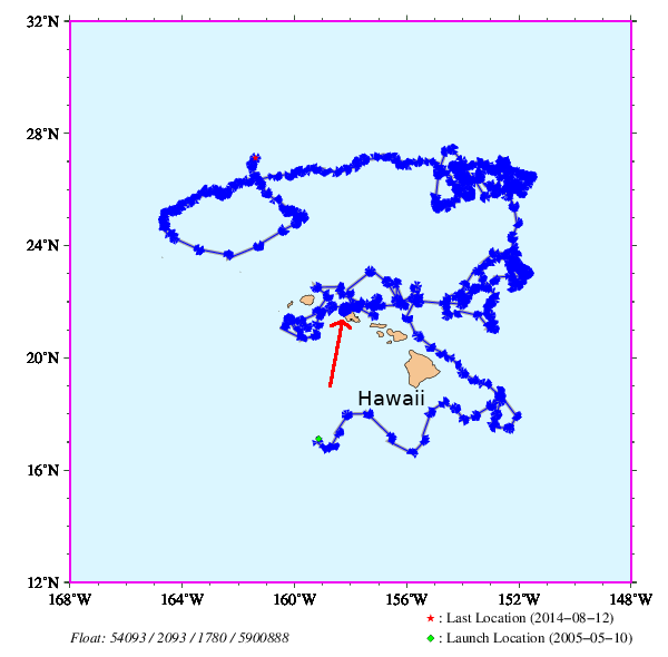
At the end of April 2007, the float got stuck on the north side of Oahu. I have marked the stuck location with an arrow above. The last profile measured showed an ocean depth of approximately 500 meters. Maybe the bottom was really sticky mud, or it got wedged between some rocks.
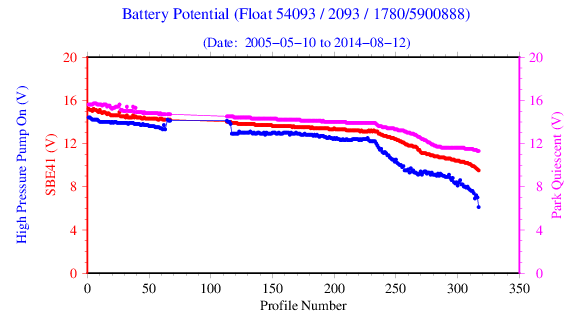
Then, at the end of August 2008, the float reappeared in the same location. It had returned from the dead! The float had tried to do 46 profiles while it was stuck to the bottom. Eventually, with enough attempted dives and floats, it managed to work itself free from whatever it was caught on. Here is some battery voltage data, clearly showing no data points where the float was stuck underwater.
After it had broken free, the float bottomed out a few more times before drifting into the deep ocean. This float ended up having a very productive life, taking another 204 profiles and living a total of 9.3 years.
2016
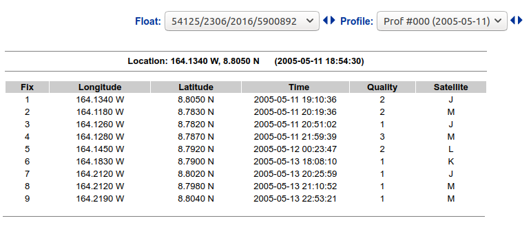
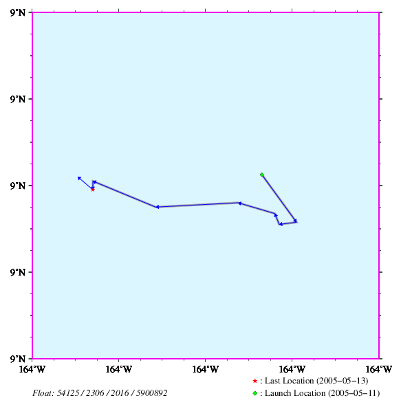
We deployed Float 2016 about 800 nautical miles southwest of Hawaii. Transmissions were received from the float for 3 days, then it went silent. This float never completed a single temperature and salinity profile.
My notes from this deployment showed that the swells were approximately 5 feet at the time it was released, and that the float dropped about 3 feet through the air before hitting the water. Maybe this damaged something inside, or the oil bladder on the bottom? We will never know.
As far as I can tell from the data, this float transmitted 9 times on the surface over the course of 52 hours, starting when we powered the float up on 11 May 2005 18:54 UTC. This is very abnormal, as the first transmission after power on is usually only a few hours long, and subsequent transmissions after a profile are about 10 hours long.
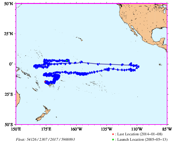
2017
Float 2017 was deployed about halfway between Hawaii and Fiji. Unlike the previous deployment, the seas were very calm.
The interesting thing about this float is that it really traveled around the South Pacific over its 8.7 year lifetime. At one point, it got caught in an eastbound equatorial current. Over the 53 days from May 9th to July 1st, 2007, the float traveled approximately 2,428 nautical miles, for an average speed of 1.9 knots (nautical miles per hour).
While that doesn't seem fast, this is the fastest speed of any of the Argo floats deployed on this cruise. You can see this speed in the trajectory plot below, indicated by the very long horizontal lines near the equator. The return trip westbound was not as fast.
2012
Float 2012 was deployed in the very early morning of May 16th 2005. This float completed 10 profiles before going silent at the end of August 2005. It probably got stuck on the bottom, as all of those 10 profiles had a maximum depth of around 1200 meters.
1777
Float 1777 was deployed near the end of our voyage, about 300 km southwest of Fiji. It floated aimlessly around the South Pacific for at total of 8.4 years.
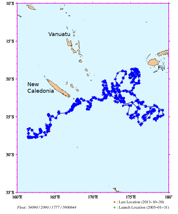
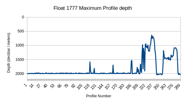
What's interesting about this float was that towards the end of its life, starting around profile 212 off the east end of New Caledonia, it found itself in very shallow waters. Since the bottom of the ocean was much shallower than the drift depth of 1000 meters (and the profile dive depth of 2000 meters), it spent a lot of time stuck on the bottom, not actually drifting with the currents. Here is a plot of the maximum profile depth for this float:
Fortunately, unlike our earlier floats 1780 or 2012, this one didn't get stuck on the bottom anywhere. Floats 1963 and 1964, which we deployed later in the voyage, also traveled in shallow waters but didn't get stuck.
Conclusion
I'm glad that something I volunteered to do 15 years ago as a college kid is actually helping quantify our changing planet. Deploying the floats was lots of fun, even when it was at 4am and all you wanted to do was sleep just a bit longer. The voyage of the TS Golden Bear was very interesting, both during the port calls but also during the long stretches of at-sea time between ports. Being far away from land really is the loneliest place on the planet. The Argo project is still launching floats, and in April 2021 there are approximately 3,775 Argo floats making measurements worldwide.
Special thanks to Dr. David Keeling at Cal Poly for managing the program and us college kids, Dr. Elizabeth Steffen from NOAA for sending us the floats, and the entire crew of the TS Golden Bear for helping us actually put them in the water.
Links
- Cal Poly at Sea webpage, courtesy of the Wayback Machine. It appears that Cal Poly isn't doing this program anymore.
- NOAA Pacific Marine Environment Laboratory float data
- On the Design and Implementation of Argo – An initial plan for a global array of profiling floats (local PDF)
- Argo: The Global Array of Profiling Floats (local PDF)
- UK-SNAP, which is looking at currents in the North Atlantic Subpolar Gyre. The data for the NY Times article actually comes from this project.