Summits on the Air (SOTA) combines two of my favorite pastimes, amateur radio and hiking. The objective is to climb to a nearby peak, then contact as many people as you can on the radio. While most SOTA peak activations are on HF, my only portable gear at the moment is a few HTs.
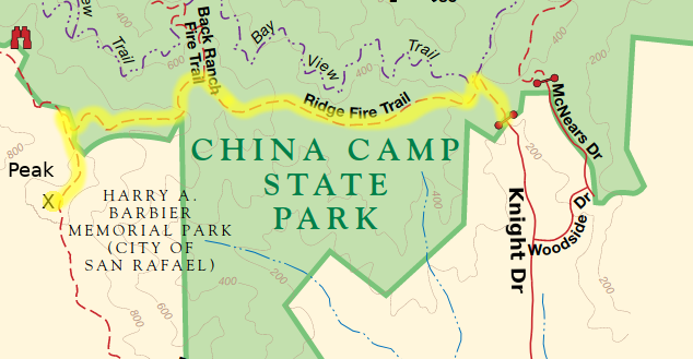
On Saturday Nov 7th, I activated San Pedro Mountain, which is 1058 ft tall. It's located in Harry A. Barbier Memorial Park in the hills above San Rafael, next to China Camp State Park.
I took the Knight Dr route, from Tom AI6CU, hiking along the Ridge Fire Road. The hike up took about 45 minutes, and some sections of the trail were very steep. I arrived on top about 12:30pm, ate a quick sandwich, and cooled off.
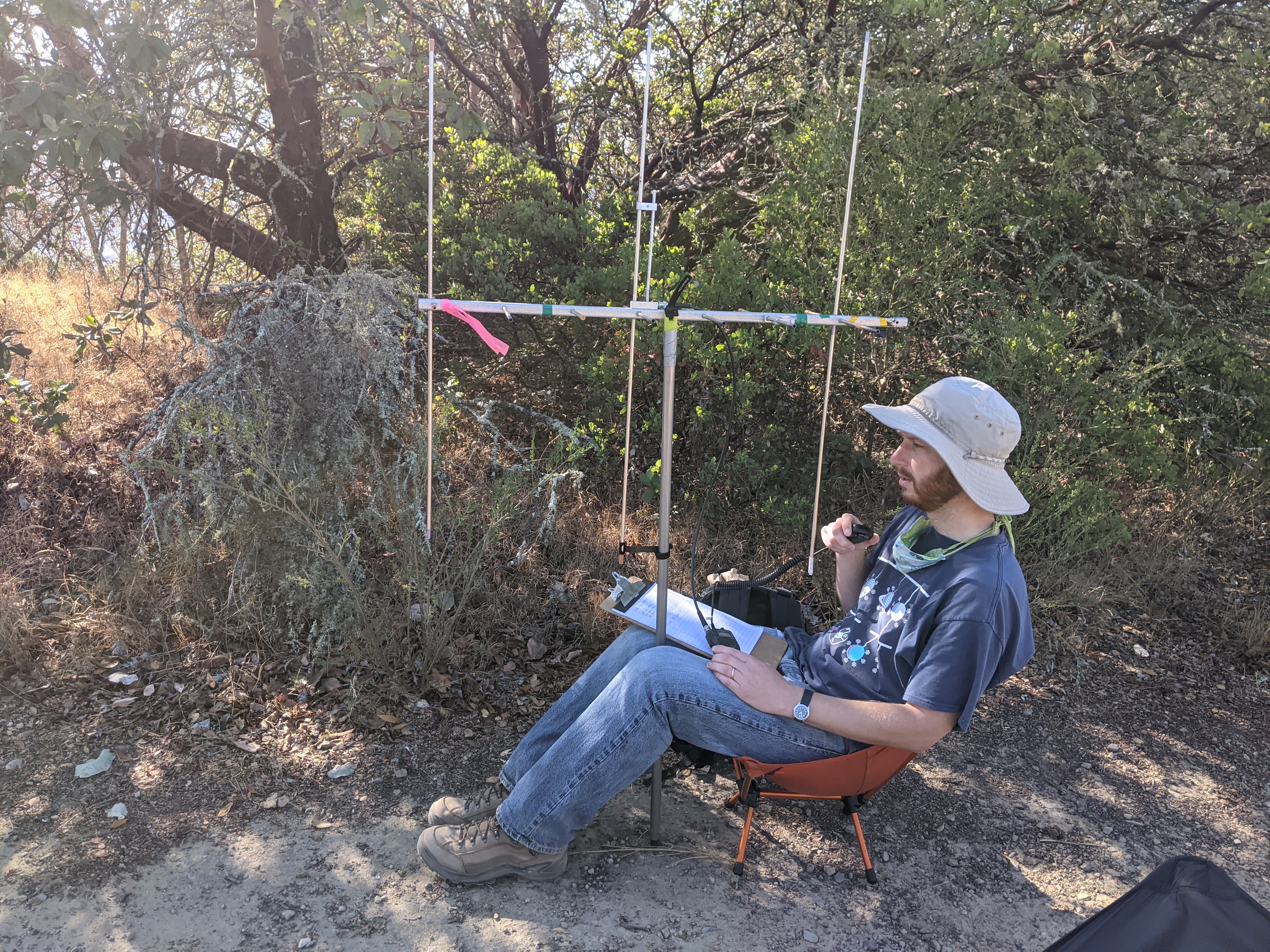
The radio equipment I was using was a 3-element Arrow II yagi antenna, and my trusty Icom IC-T7H handheld transceiver. RF output was about 1 watt, and the gain of the antenna was about 5 dB. Unfortunately, I only had a metal broomstick to hold the yagi up, so that probably messed with the radiation pattern a bit.
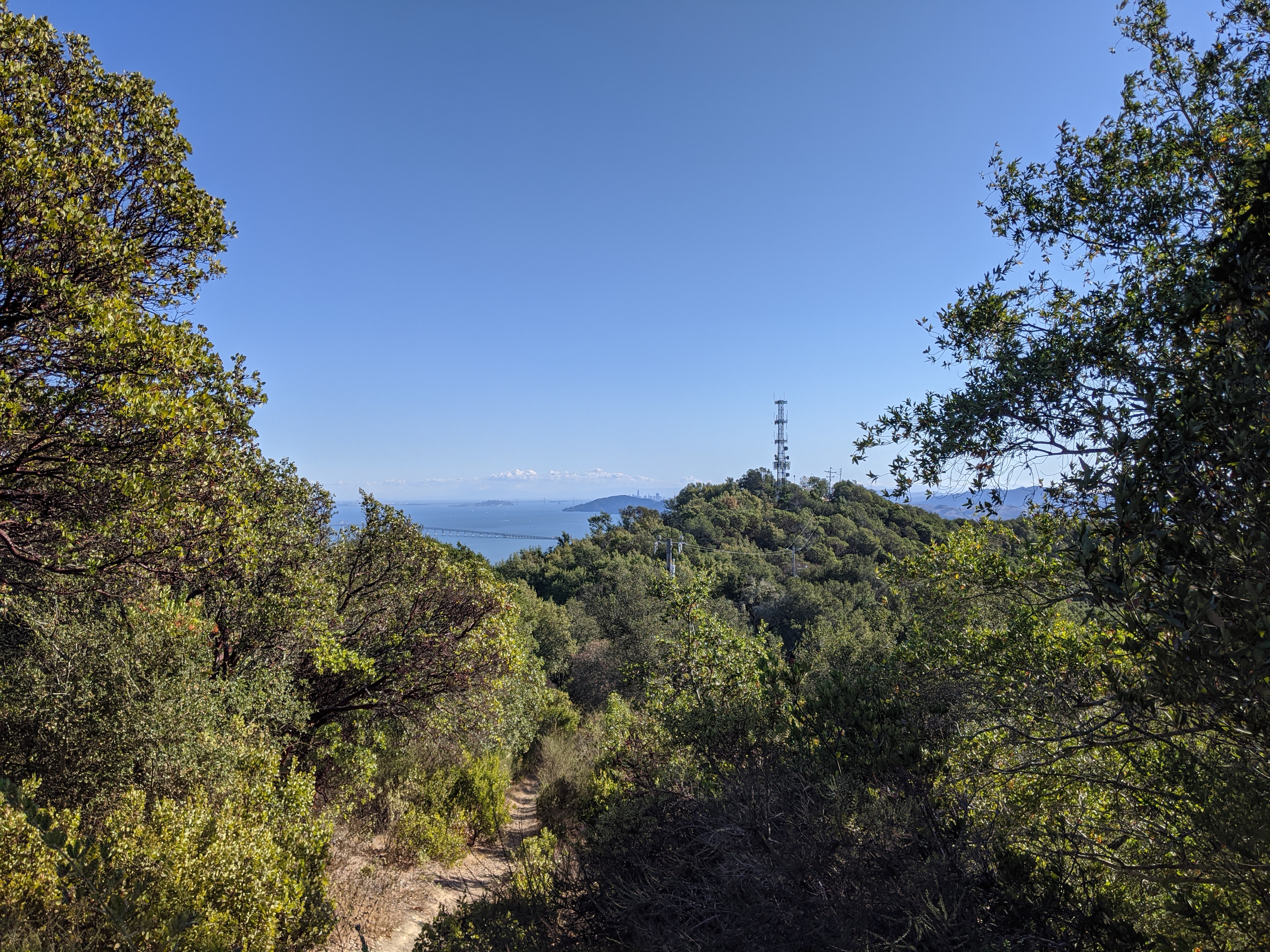
The views from the top were pretty good, but the trees were blocking most of it. The Richmond-San Rafael Bridge, Bay Bridge, Angel Island, and downtown San Francisco were visible thru a break in the tree cover. Other views were mostly blocked.
There was a lot of RF interference at the peak. With the squelch open on my HT, the noise was always S9, increasing to S9+20dB for several minutes at a time. This made contacts very difficult, some people had a loud buzz on their signals, and many others were too weak to decode. Even with all the RF noise, I made a total of 7 contacts on 146.52 MHz. I tried 446.0 MHz also, but the noise was too great to hear anybody.
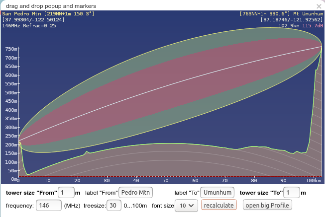
The furthest contact I made was with Alex KN6BAZ, who was out hiking in the Sierra Azul Preserve on top of Mt. Umunhum above Los Gatos. Mt. Umunhum is actually another SOTA peak. He was running only 5 watts into an omnidirectional HT antenna, and the link was 63 miles.
Looking at the link profile tool on the Hamnet-DB map, the clear shot line-of-sight link was 63 miles long with 115 dB of path loss. My altitude was just under 1000 ft, and he was around 2,600 ft.
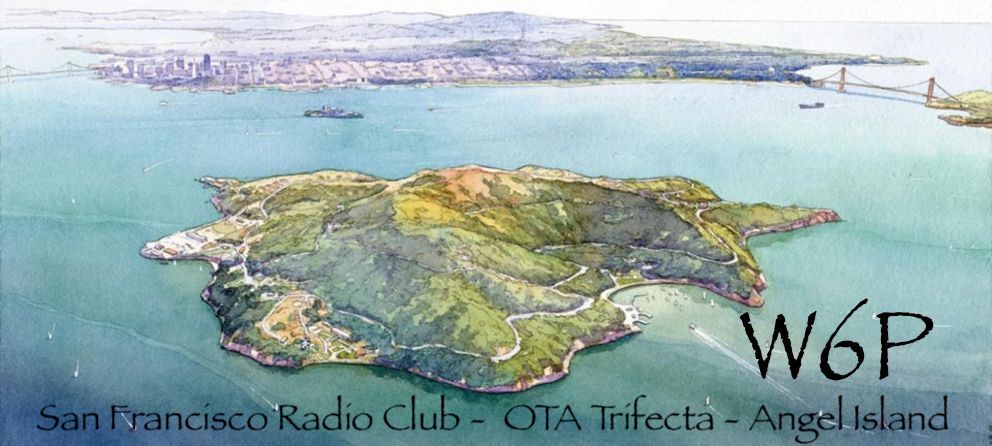
At the same time as my SOTA activation, the San Francisco Radio Club was on Angel Island. They had a whole expedition going, and obtained a special event callsign W6P. They had twelve people at three separate sites, with three separate portable HF stations, doing a SOTA, Parks on the Air (POTA), and US Islands on the Air (IOTA) activation. I made a summit-to-summit contact with them.